The Patriot Files Forums The Patriot Files Forums |
|
Before enlarging, click photo to ensure maximum resolution.
|
|
|
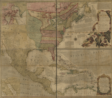
An accurate map of North
 Photo Details
|
David
Administrator
Registered: August 2001
Posts: 46,798

|
An accurate map of North America. Describing and distinguishing the British, Spanish and French dominions on this great continent; according to the definitive treaty concluded at Paris 10th Feby. 1763. Also all the West India Islands belonging to, and possessed by the several European princes and states. The whole laid down according to the latest and most authentick improvements, by Eman. Bowen, geogr. to His Majesty and John Gibson, engraver. Bowen, Emanuel, d. 1767.
|
· Date: Tue December 10, 2002 · Views: 1521
· Filesize: 159.1kb · Dimensions: 436 x 382 ·
|
|
Additional Info
|
|
Keywords: An accurate map of North
|
All times are GMT -7. The time now is 02:49 AM.